Blender create a 3d map
From wikiluntti
Introduction
Use open data from Maanmittauslaitos. Get
- Ilmakuva
- Korkeusmalli
- Kartta
and use those to create a 3d animation.
Theory
-
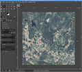
The original image from MML website. Note that the file size is huge.
-
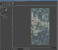
Combined.
-
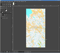
The map combined.
Combine the data (GIMP can open jp2 data format; the height model tif is scaled such that GIMP is having problems).
Height Model
The height model provided by MML is N2000 standard. The format is GeoTIFF. See
- https://www.maanmittauslaitos.fi/peruspaikkatietojen-yllapito
- https://www.maanmittauslaitos.fi/sites/maanmittauslaitos.fi/files/attachments/2017/05/KMTK_korkeusmallit_laatukasikirja_2017-01-02.pdf
- https://www.maanmittauslaitos.fi/kartat-ja-paikkatieto/aineistot-ja-rajapinnat/tuotekuvaukset/korkeusmalli-2-m
- https://ckan.ymparisto.fi/dataset/korkeusmalli-2-m-km2


