AIS visualization TASK: Difference between revisions
From wikiluntti
| Line 7: | Line 7: | ||
The position of vessels on a photo. | The position of vessels on a photo. | ||
== Data acquisition == | |||
USE RTL-AIS, ship162 (https://github.com/xoolive/ship162) project and Python, with tape measure antenna. | |||
== Transform == | == Transform == | ||
Revision as of 10:11, 15 May 2026
Introduction
-
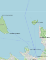
The map and some coordinates
-

The map shall be transformed to photo


The position of vessels on a photo.
Data acquisition
USE RTL-AIS, ship162 (https://github.com/xoolive/ship162) project and Python, with tape measure antenna.


