AIS visualization TASK: Difference between revisions
| (12 intermediate revisions by the same user not shown) | |||
| Line 16: | Line 16: | ||
=== AIS Data format === | === AIS Data format === | ||
My AIS data looks like following | |||
<syntaxhighlight lang="bash"> | |||
AISSentence<!AIVDM,1,1,,A,147MT`00011i6jpR1JV@97nj0D1v,0*1E> | |||
AISSentence<!AIVDM,1,1,,A,147>aD0P?w<tSF0l4Q@>4?wp0UrD,0*62> | |||
AISSentence<!AIVDM,1,1,,B,347eHF5000QiHiHR0u;ooiFj2000,0*41> | |||
AISSentence<!AIVDM,2,1,3,A,547GF<81AcKHE=`4001@58lt000000000000001J5@c;;uGa0@25CQ2D,0*50 | |||
!AIVDM,2,2,3,A,1@@000000000000,2*26> | |||
AISSentence<!AIVDM,1,1,,A,147sn80000Qi9N4R1JV=r16n04HH,0*17> | |||
AISSentence<!AIVDM,2,1,4,B,5482L002;29tE<iR221HDM@TpB2222222222220`1P>3540003l0E0DQ,0*35 | |||
!AIVDM,2,2,4,B,BO@AAkPH8888880,2*1D> | |||
AISSentence<!AIVDM,1,1,,B,1480bf0P001i5A`R1IRP>gvt0d1t,0*62> | |||
AISSentence<!AIVDM,1,1,,B,33ni`v5P00Qi5BpR1I1@6wwj0000,0*69> | |||
AISSentence<!AIVDM,1,1,,A,402`m?1vaT36WQieB8R3TQ?02L5V,0*53> | |||
</syntaxhighlight> | |||
so there are extra texts, like <code>AISSentence<</code> which needs to be removed. The multipart message is partly combined already. The first 1 or 2 describe how many parts the message is divided into, A and B describe the channel, and the last part is the message. | |||
The cleaned AIS data looks like: | |||
<syntaxhighlight lang="bash"> | |||
!AIVDM,1,1,,A,147MT`00011i6jpR1JV@97nj0D1v,0*1E | |||
!AIVDM,1,1,,A,147>aD0P?w<tSF0l4Q@>4?wp0UrD,0*62 | |||
!AIVDM,1,1,,B,347eHF5000QiHiHR0u;ooiFj2000,0*41 | |||
!AIVDM,2,1,3,A,547GF<81AcKHE=`4001@58lt000000000000001J5@c;;uGa0@25CQ2D,0*50 | |||
!AIVDM,2,2,3,A,1@@000000000000,2*26 | |||
!AIVDM,1,1,,A,147sn80000Qi9N4R1JV=r16n04HH,0*17 | |||
!AIVDM,2,1,4,B,5482L002;29tE<iR221HDM@TpB2222222222220`1P>3540003l0E0DQ,0*35 | |||
!AIVDM,2,2,4,B,BO@AAkPH8888880,2*1D | |||
!AIVDM,1,1,,B,1480bf0P001i5A`R1IRP>gvt0d1t,0*62 | |||
!AIVDM,1,1,,B,33ni`v5P00Qi5BpR1I1@6wwj0000,0*69 | |||
!AIVDM,1,1,,A,402`m?1vaT36WQieB8R3TQ?02L5V,0*53 | |||
</syntaxhighlight> | |||
https://open-ais.org/docs/Data-Architecture/ | https://open-ais.org/docs/Data-Architecture/ | ||
| Line 31: | Line 62: | ||
Sqlite3 database | Sqlite3 database | ||
<syntaxhighlight lang=" | <syntaxhighlight lang="SQL"> | ||
CREATE TABLE ais_data ( | CREATE TABLE ais_data ( | ||
id INTEGER PRIMARY KEY AUTOINCREMENT, | id INTEGER PRIMARY KEY AUTOINCREMENT, | ||
| Line 50: | Line 81: | ||
The following code [[AIS Save to database using Python]] will save the data. | The following code [[AIS Save to database using Python]] will save the data. | ||
=== Vessel data === | |||
Create one simple database to include some more static data. However, the name might change but this will not take that into account. | |||
AIS Type 5 (Ship Static and Voyage Related Data) provides the core vessel identity and voyage information. The data items typically included are: | |||
*MMSI -> mmsi | |||
*Vessel name -> name (sometimes vessel_name depending on dataset) | |||
*IMO number -> imo (The permanent, unchanging identifier for vessels worldwide) | |||
*Call sign -> callsign (sometimes call_sign) | |||
*Vessel type (ship type code) -> shiptype (sometimes type_id) | |||
*Cargo type -> cargo_type | |||
*Length overall (LOA) -> length | |||
*Beam -> width | |||
*Gross tonnage -> gt | |||
*Net tonnage -> nt | |||
*Destination -> destination | |||
*Estimated Time of Arrival (ETA) -> eta | |||
*Draft -> draught (or draft) | |||
*Vessel status / navigational status -> nav_status (or navig_status) | |||
'Flag state (nation) -> flag | |||
*Owner -> owner | |||
*Route / voyage number -> voyage_id or voyage (depends on dataset) | |||
<syntaxhighlight lang="SQL"> | |||
CREATE TABLE IF NOT EXISTS vessels ( | |||
mmsi INTEGER NOT NULL, | |||
name TEXT, | |||
flag TEXT, | |||
shiptype INTEGER, | |||
shiptype_name TEXT, | |||
callsign TEXT, | |||
length REAL, | |||
width REAL, | |||
gt REAL, | |||
nt REAL, | |||
draught REAL, | |||
timestamp DATETIME DEFAULT CURRENT_TIMESTAMP, | |||
PRIMARY KEY (mmsi) | |||
); | |||
</syntaxhighlight> | |||
== Transform == | == Transform == | ||
Latest revision as of 17:49, 2 July 2026
Introduction
-
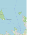
The map and some coordinates
-

The map shall be transformed to photo


The position of vessels on a photo.
Software
- rtl_ais -n -> parser -> database
- Ship162 is nice
ship162 --interactive rtlsdr:// - AIS-catcher https://github.com/jvde-github/AIS-catcher COULDN't get working
- GNU AIS is old, GNU radio is newer but rather heavy.
AIS Data format
My AIS data looks like following
AISSentence<!AIVDM,1,1,,A,147MT`00011i6jpR1JV@97nj0D1v,0*1E>
AISSentence<!AIVDM,1,1,,A,147>aD0P?w<tSF0l4Q@>4?wp0UrD,0*62>
AISSentence<!AIVDM,1,1,,B,347eHF5000QiHiHR0u;ooiFj2000,0*41>
AISSentence<!AIVDM,2,1,3,A,547GF<81AcKHE=`4001@58lt000000000000001J5@c;;uGa0@25CQ2D,0*50
!AIVDM,2,2,3,A,1@@000000000000,2*26>
AISSentence<!AIVDM,1,1,,A,147sn80000Qi9N4R1JV=r16n04HH,0*17>
AISSentence<!AIVDM,2,1,4,B,5482L002;29tE<iR221HDM@TpB2222222222220`1P>3540003l0E0DQ,0*35
!AIVDM,2,2,4,B,BO@AAkPH8888880,2*1D>
AISSentence<!AIVDM,1,1,,B,1480bf0P001i5A`R1IRP>gvt0d1t,0*62>
AISSentence<!AIVDM,1,1,,B,33ni`v5P00Qi5BpR1I1@6wwj0000,0*69>
AISSentence<!AIVDM,1,1,,A,402`m?1vaT36WQieB8R3TQ?02L5V,0*53>
so there are extra texts, like AISSentence< which needs to be removed. The multipart message is partly combined already. The first 1 or 2 describe how many parts the message is divided into, A and B describe the channel, and the last part is the message.
The cleaned AIS data looks like:
!AIVDM,1,1,,A,147MT`00011i6jpR1JV@97nj0D1v,0*1E
!AIVDM,1,1,,A,147>aD0P?w<tSF0l4Q@>4?wp0UrD,0*62
!AIVDM,1,1,,B,347eHF5000QiHiHR0u;ooiFj2000,0*41
!AIVDM,2,1,3,A,547GF<81AcKHE=`4001@58lt000000000000001J5@c;;uGa0@25CQ2D,0*50
!AIVDM,2,2,3,A,1@@000000000000,2*26
!AIVDM,1,1,,A,147sn80000Qi9N4R1JV=r16n04HH,0*17
!AIVDM,2,1,4,B,5482L002;29tE<iR221HDM@TpB2222222222220`1P>3540003l0E0DQ,0*35
!AIVDM,2,2,4,B,BO@AAkPH8888880,2*1D
!AIVDM,1,1,,B,1480bf0P001i5A`R1IRP>gvt0d1t,0*62
!AIVDM,1,1,,B,33ni`v5P00Qi5BpR1I1@6wwj0000,0*69
!AIVDM,1,1,,A,402`m?1vaT36WQieB8R3TQ?02L5V,0*53
https://open-ais.org/docs/Data-Architecture/
https://gpsd.gitlab.io/gpsd/AIVDM.html
Data acquisition
USE RTL-AIS, ship162 (https://github.com/xoolive/ship162) project and Python, with tape measure antenna.
Or GNU AIS saves the data to local MySQL server.
rtl_ais
Sqlite3 database
CREATE TABLE ais_data (
    id INTEGER PRIMARY KEY AUTOINCREMENT,
    ts DATETIME DEFAULT CURRENT_TIMESTAMP,
    mmsi INTEGER,
    msg_type INTEGER,
    lat REAL,
    lon REAL,
    sog REAL,
    cog REAL,
    heading REAL,
    shipname TEXT,
    raw TEXT
);
Use it eg from the command line: sqlite3 ais.db "SELECT COUNT(*) FROM ais_data;".
The following code AIS Save to database using Python will save the data.
Vessel data
Create one simple database to include some more static data. However, the name might change but this will not take that into account.
AIS Type 5 (Ship Static and Voyage Related Data) provides the core vessel identity and voyage information. The data items typically included are:
- MMSI -> mmsi
- Vessel name -> name (sometimes vessel_name depending on dataset)
- IMO number -> imo (The permanent, unchanging identifier for vessels worldwide)
- Call sign -> callsign (sometimes call_sign)
- Vessel type (ship type code) -> shiptype (sometimes type_id)
- Cargo type -> cargo_type
- Length overall (LOA) -> length
- Beam -> width
- Gross tonnage -> gt
- Net tonnage -> nt
- Destination -> destination
- Estimated Time of Arrival (ETA) -> eta
- Draft -> draught (or draft)
- Vessel status / navigational status -> nav_status (or navig_status)
'Flag state (nation) -> flag
- Owner -> owner
- Route / voyage number -> voyage_id or voyage (depends on dataset)
 CREATE TABLE IF NOT EXISTS vessels (
mmsi INTEGER NOT NULL,
name TEXT,
flag TEXT,
shiptype INTEGER,
shiptype_name TEXT,
callsign TEXT,
length REAL,
width REAL,
gt REAL,
nt REAL,
draught REAL,
timestamp DATETIME DEFAULT CURRENT_TIMESTAMP,
PRIMARY KEY (mmsi)
);
Transform
Some ideas to generate the transformation. Full camera projection is not needed here.
The latitude/longitude scale is not a linear measure. Thus, to a conversion to metric scale is better. UTM projection (pyproj) or using a local tangent plane. The UTM projection works better for this 10-20 km distances.
Plan
The coordinate system of the map is WGS84 EPS:4326 to EPSG:32635.
The mapping and ideas
- Get the mapping ship's GNSS coordinates to image coordinates
- Convert GNSS coordinates to UTM and then to metric points. Change the origin such that the metric numbers are reasonable.
- Find the corresponding pixels at the photo image.
- Compute homography matrix
- For testing purposes plot the GNSS value on the map.
- Create other homology mapping between GNSS coordinates and the map
- Create other homology mapping between GNSS coordinates and the map
UTM projection
The latitude/longitude scale is not a linear measure. Thus, to a conversion to metric scale is better. UTM projection (pyproj) or using a local tangent plane. The UTM projection works better for this 10-20 km distances.
# WGS84 GPS -> UTM zone 35N
transformer = Transformer.from_crs(
    "EPSG:4326",
    "EPSG:32635",
    always_xy=True
)


gps_points = np.array([
[59.4480442,24.7727679],
[59.4720746,24.7267166],
[59.5183884,24.7962952],
[59.5226077,24.5841614],
[59.5770763,24.7294084]
])

utm_points = []
for lon, lat in gps_points:
    x, y = transformer.transform(lon, lat)
    utm_points.append([x, y])

x0, y0 = utm_points[2]
local_points = []
for x, y in utm_points:
    local_points.append([x - x0, y - y0])

print(local_points)
Homology
https://docs.opencv.org/4.x/d9/dab/tutorial_homography.html
The simplest;

Should have some 10-50 corresponding pairs to get the mapping correct. Use least squares or SVD, but OpenCV works with RANSAC.
Non rigid spatial warp
Thin plate spline, where and



